Contents
Introduction
The goal of this project was to discover how far one could get from the zoo before being intercepted by police. I won’t get into the thinking behind it, but will record my methodology.
We need three main pieces of data for this project:
- A zoo.
- Police stations near that zoo.
- A network dataset of roads around the study area. This is the tricky one.
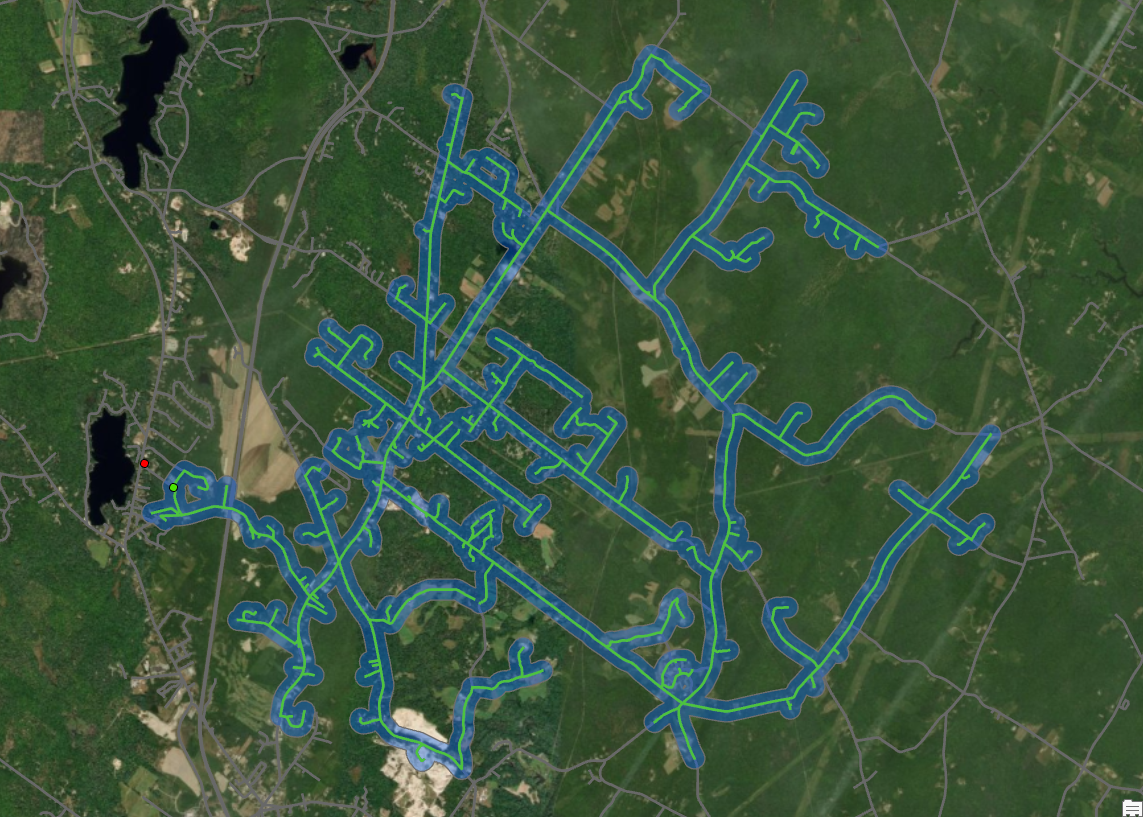
With this data, we perform some network analysis to discover how far in every direction on the road one could get from the zoo, before one could get there from the nearest police station. This analysis should produce, in effect, a web from the zoo of possible escape routes, each route coming to a dead-end where the cops could intercept.
Assembling Data
Zoo
I chose Maine Wildlife Park in Gray as my zoo of study. There are not many zoos around that call themselves a zoo.
- I found Maine Wildlife Park in Google, and recorded the address fields into a new tab-delimited .txt file, as shown below.
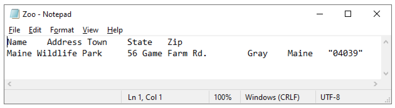
Figure 1: Zoo.txt
- I brought this table into ArcGIS, and put it on the map by geocoding it using the address.
- I got the geocoder that can do this through prof. Youngs’ in-class-assignment-8 explanation.
Police Stations
- I visited the MEGIS catalog and downloaded the Maine-Law-Enforcement-E911 shapefile.
- Then I just pulled it into ArcGIS.
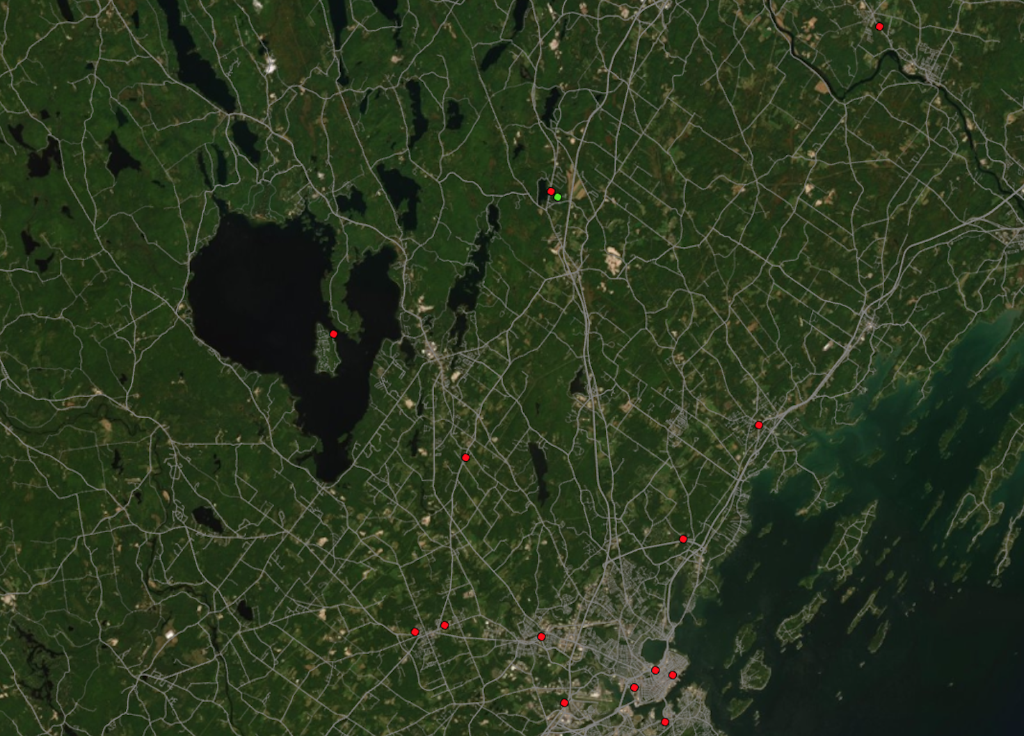
Figure 2: The Zoo (light green circle), and all nearby police stations (red circles). There is a station directly West of the zoo that will cut off any escape routes in that direction
Network Dataset (Roads)
To use network analysis tools, you need a network dataset. This is like a roads shapefile except it includes all of the things an application needs to solve routing problems – turns, speed limits, number/direction of lanes, barriers
The easiest way I could create a network dataset for the roads in my study area was to use the OSM toolbox for ArcMap, which contained tools for turning Open Street Map data into a network dataset Arc can work with. That tool box is found at github.com/Esri/arcgis-osm-editor. The instructions I followed are in the documentation on that repository. This involved importing data from Open Street Map, and using the OSM toolbox in ArcMap to convert that data into a network dataset. When selecting the bounding box from within which all OSM data was exported, I went with 43.5 to 44.5 Latitude, -69.7 to -70.7 Longitude. This was more than big enough.
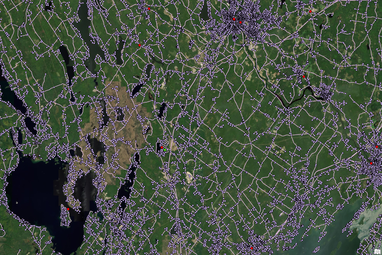
Figure 3: Network dataset for the study area. All roads, intersections, etc.
- I saved the network dataset into my geodatabase, and brought it into my ArcGIS Pro project.
Analysis
Network Analyst Tools: Closest Facility
- Next I made sure the Network Analysis toolset was licensed and enabled.
- I was going to do service areas, and erase the extent of the police’s services area from that of the zoo’s service area, for several amounts of time. But I realized that the Closest Facility tool would work better.
- Before I could use this tool I needed to put both the zoo and the police stations in one feature class.
- So I started an edit session and made one more point in the police file, right where the zoo is.
- I gave that point a unique identifying ID. It will function as the zoo for the coming analysis.
- I opened the tool to Make Closest Facility Analysis Layer using the network dataset I made.
- Then once I had that layer, I clicked it and opened the new tab that appeared at the top of the ArcGIS window, where you can fill in the parameters.
- I clicked Add Facility, which opened the Add Locations tool. I added the police stations feature class as the facility, which also had the location of the zoo as one of its points.
- When that finished, I returned to the Closest Facility tab and this time clicked the button to fill in the Incident(s).
What the Closest Facility tool does is find, for any given “incidents”, what is the quickest (or closest, depending on what impedance is chosen in your network dataset) of the given “facilities” one could reach. From the sounds of it this tool is better suited to answer my question than the other one. And what to use as an Incidents dataset? The intersection points in the network dataset. There are thousands of them, so we'll get a fairly high-resolution result.
- Select the intersection points file in the network dataset as the Incident(s).
- Make sure the rest of the parameters are good. Make sure we are finding routes FROM facilities (Because we are looking for the routes FROM the zoo and police stations).
- Hit Run. This will give us an enormous web of routes.
- Select by Attribute: those leading to the point representing the zoo.
- Export that selection of data to its own file.
The result is a web of all viable escape routes: all the intersections to which the zoo is the closest facility.
Conclusion
As you can see, there is a considerable range, considering this is imagining that all police stations immediately deploy straight to the same intersections as the escapee.
See PDF Map/Report Visual
Scott Waechter