Minor God
This project was done with Javascript, the Three.js library, GLSL shaders, and HTML, for COS 420: Computer Graphics at USM.
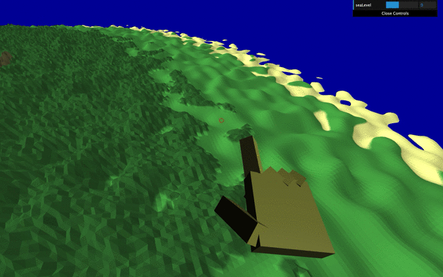
Minor God is a game in which you move a giant hand made of simple geometry around an island, smiting the land with lightning as you please. There are also sea-level controls. The island's terrain is generated by a noise function in the vertex shader, and the colours are determined in the fragment shader.
My goal was to do as much generation as possible using noise in the shaders. What interested me was the challenge and the reward of working in GLSL shaders -they are more finicky than javascript, and have more unusual rules, but allow you to process so much so beautifully inside the GPU. I was also particularly interested in terrain deformation.
This was mostly an exercise in using Three.js, and GLSL shaders, but given more time I would have liked to improve the experience of it with sound, better lighting, better terrain texture and colour, better movement, etc. I also wanted to apply a vertex shader to the water to create waves.
This project was done in Fall 2019.
Locating America's Hidden Psychic Population
This project was done using ArcMap, for GEO 308: GIS Applications I at USM.
The idea was that FM radio will have a negative cognitive effect on psychics, and that to find where there are most likely psychics, we look for the places of highest negative correlation between number of FM frequencies in range, and academic performance.
The real goal was not to solve any real world problem, but to acquaint myself with a variety of GIS tools and practices. As outlined in the report linked here, I had to source/create, and process data for import, calculate new data fields, work with disparate coordinate systems, geocode, buffer, intersect, dissolve, and use spatial analysis tools.
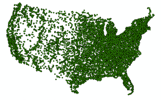
One of the best parts was the breakthrough of figuring out how to calculate, for each point in a shapefile, how many buffers from another shapefile are overlapping that point. Another part that took a while was figuring out how to perform the climactic raster analysis with the Point Statistics tool. My favourite part however, was creating the USA-wide FM radio signal buffer shapefile using a poorly reverse-engineered propagation curve algorithm from the FCC website.
This project was done in Fall 2019.
Zoo Escape!
This project was done using ArcGIS Pro, for GEO 108: Introduction to ArcGIS at USM.
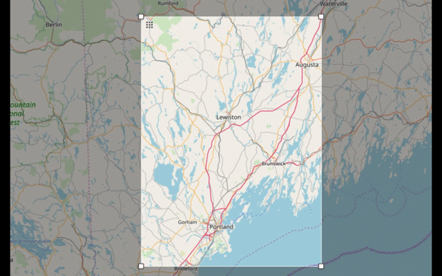
The aim of this project was to figure out how far from the zoo one could get before the police could intercept. The assumption is that upon leaving the zoo, police from all nearby stations are immediately dispatched and will take the quickest route to the escapee.
The "zoo" used for study was Maine Wildlife Park. This analysis could be fairly easily recreated using a different zoo, by following the process outlined in the report linked here, given that shapefiles are available for police stations in the vicinity.
The part of interest was getting the network dataset (the roads and all related details, such as speed limits, intersections, barriers, etc.), and performing the subsequent network analysis. The network dataset was derived form Open Street Map data using the OSM Toolbox for ArcMap. The central analysis was done with the Closest Facility tool in ArcGIS
This project was done in Fall 2019.